Campbell River Master Transportation Plan
Consultation has concluded
Update March 2026
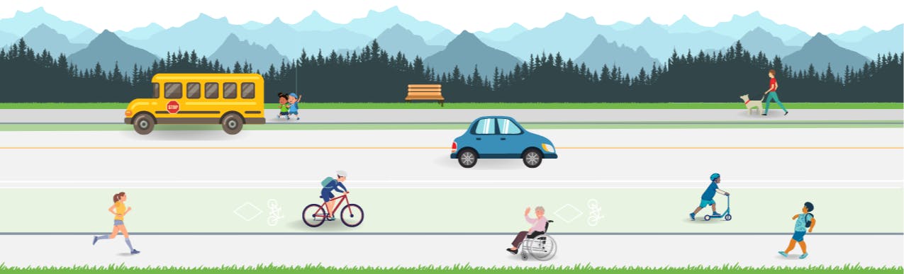
The City of Campbell River updated its Master Transportation Plan (MTP), a long-term strategy to improve mobility, safety and accessibility across Campbell River's transportation network over the next 10 years. A final draft MTP was presented to and adopted by Council on March 24, 2026.
Watch the Final MTP Presentation to Council
Highlights of the plan include recommendations for improvements and added infrastructure for roads, sidewalks, cycling, multi-use pathways, transit and supportive policies and programs.
In the short-term (one to three years), the following improvements are planned:
- Roads
- Quinsam Heights Transportation Growth Study,
- Highway 19 new connection feasibility study,
- Dogwood Street traffic signal timing update,
- Safety improvements at Highway 19A / Shoppers Row traffic signal, and
- Better multi-use pathway pavement markings at intersections.
- Pedestrian infrastructure
- New sidewalks on 16th Ave, 7th Avenue, and Erickson Road (pending grant funding),
- New pedestrian connection on 9th Avenue between Thulin Street and Pier Street (improving access to downtown), and
- New pedestrian connection on Pinecrest Road between Carnegie Street and Highway 19A (providing access to the waterfront).
- Cycling infrastructure
- Review of the Hilchey Road corridor and implementation of changes to promote safety for all road users,
- Completion of the neighbourhood bikeway on Birch Street, and
- New neighbourhood bikeways on Cheviot Road and the Thulin-Murphy-Galerno corridor (from Rockland Road to downtown).
- Multi-use pathways
- Completion of the multi-use pathway on Willis Road (with the addition of a small section by Highway 19),
- New multi-use pathways on McPhedran Road from the north end to 4th Avenue, and Erickson Road (pending grant funding), and
- Maintenance of the Strathcona Gardens connector.
- Transit improvements
- Review of bus stop infrastructure and service frequency improvements.
- Supportive policies and programs
- Update designated truck routes,
- Update Neighbourhood Traffic Management Policy and procedures,
- Collaborate with SD72 for an Active School Travel pilot program,
- Update the Zoning Bylaw to include bicycle parking,
- Undertake an off-street parking review, and
- Undertake a downtown parking and curbside management study.
The Master Transportation Plan aims to equip residents with transportation options that are safe, comfortable, affordable and accessible for all ages and abilities.
Planning Process
Phase 1 - Research and Consultation: Existing conditions, data collection and first round of public input (2022)
Phase 2 - Vision and Priorities: Refining goals, prioritizing projects and costing (2022-2023)
Phase 3 - Policy and Draft Plan: Developing policy directions and drafting the plan (2023-2025)
Phase 4 - Plan Refinements (Fall/Winter 2025)
Phase 5 - Finalization and MTP adoption (Winter/Spring 2026)
To learn more about transportation at the City of Campbell River, visit www.campbellriver.ca/transportation.
Quinsam Heights Transportation and Growth Study (TGS)
At the Committee of the Whole meeting on May 20, 2025, Council approved the initiation of the Quinsam Heights Transportation and Growth Infrastructure Study, which stems from the work that’s being done to update the Master Transportation Plan.
Campbell River is a growing community, and the Quinsam Heights neighbourhood has been identified as a growth area to help accommodate the community's housing needs. The City is conducting the TGS to guide long-term neighbourhood planning and identify infrastructure upgrades that support growth, mobility, and public safety. This two phase study will evaluate options to address current and future transportation needs in the Quinsam Heights area.
Phase One
Phase one focuses on improvements to Petersen Road, assessing current and future traffic demands related to growth in Quinsam Heights. The study will examine operational challenges, safety concerns, and multimodal connectivity to ensure the corridor can support anticipated development.
The study aims to:
- Improve transportation safety and connectivity for all users, including residents, pedestrians, and cyclists
- Identify infrastructure upgrades needed to support future housing, services, and growth
- Develop a plan that supports long-term neighbourhood development
Data collection along Petersen Road will begin in early 2026 and will include traffic counts, as well as aerial and in person surveys. The study will document existing conditions, assess transportation constraints, and identify opportunities to enhance connectivity, safety, and capacity for growth over the next 10-20 years.
The City will keep the public informed throughout the process and work to minimize any disruptions to residents, pedestrians, and road users.
Phase Two
Following the completion of Phase one and the Petersen Road assessment, and pending approval from Council, Phase two would look at options to increase the capacity of the road network in this area to address current and future transportation needs. Several options would be considered, including exploring the feasibility of upgrading the Elk River Timber (ERT) road corridor to accommodate vehicle traffic, as it did back in 2001, with a separate multi-use pathway for pedestrians and cyclists.
This assessment would examine the pros, cons, and overall feasibility of such a route and include dedicated public engagement, providing data for informed decision-marking. Conducting this study would not mean the ERT reconstruction project will proceed but would rather serve as an evaluation to determine whether further consideration is warranted.
Phase two would involve extensive public engagement and outreach, and would incorporate feedback gathered from previous engagements, such as the Quinsam Heights Neighbourhood Plan, the Master Transportation Plan, and the Parks, Recreation and Culture Master Plan. It would also include reviewing topographical and environmental constraints and obtaining high-level cost estimates.
Questions? Please call 250-286-5700 or email transportation@campbellriver.ca
Who's Listening
-
Director of Community Planning and Liveability

Phone 250-286-5707 Email andy.gaylor@campbellriver.ca
Document Library
-
 2012 Master Transportation Plan (13.4 MB) (pdf)
-
Phase 1 Baseline Conditions Report (15.3 MB) (pdf)
-
Phase 2 Preliminary Recommendations Report.pdf (7.5 MB) (pdf)
-
Phase 2 Open House Posters from June 2023.pdf (15 MB) (pdf)
-
Phase 2 Public Engagement Summary.pdf (2.96 MB) (pdf)
-
Phase 3 Open House Posters from April 2024.pdf (18.1 MB) (pdf)
-
Dogwood Corridor Study.pdf (669 KB) (pdf)
-
Campbell River Master Transportation Plan 2026 Final.pdf (16.2 MB) (pdf)
